Port of San Francisco Waterfront Resilience Program
How do we embrace the past and look to the futurewhile planning for a safe, resilient, and imaginative waterfront?
CMG
Port of San Francisco Waterfront Resilience Program
The Port of San Francisco’s Waterfront Resilience Program (WRP) aims to address immediate hazards (seismic and flood risk) and plan for long-term hazards (sea level rise) across 7.5 miles of San Francisco’s shoreline. In addition to building a more physically resilient shoreline, the WRP enables the Port to preserve critical assets and respond to community priorities for the future waterfront.
These include not only resilience to hazards, but nature-based solutions, equitable community investments, the protection of historic elements, and iconic, publicly-accessible, and well-connected civic spaces. Through a collaboration with the U.S. Army Corps of Engineers, the Port is looking to secure funding for at least $13.5B from congress to execute on San Francisco’s largest infrastructure project of this century.
Location / Date:
San Francisco, CA / 2020 - Present
Status:
Ongoing
Site area:
7.5 miles
Client:
Port of San Francisco / Jacobs Engineering
Design Collaborators:
CMG Landscape Architecture
In the News:
San Francisco Waterfront Flood Study
How SF’s Embarcadero could be transformed by this $13.5 billion proposal
S.F.’s plan to protect the city from sea-level rise will ‘set the stage for our future shoreline
Draft Waterfront Adaptation Strategies and the Draft Plan
SITELAB plays a key role in advancing and steering the WRP including convening five city agencies with the Port and CH2M/Arcadis to develop the San Francisco Waterfront Flood Study Draft Plan for the 7.5-mile waterfront.
SITELAB, in collaboration with other designers and climate experts, developed waterfront-wide draft adaptation strategies based on geographic and urban conditions along the waterfront, from Fisherman’s Wharf to Islais Creek. These draft strategies were assessed with the U.S. Army Corps of Engineers to collaboratively create the Draft Plan. The Draft Plan is the first of its kind at this scale to comprehensively maximize benefits across the waterfront, an approach that elevates equity and environmental priorities.
Different Approaches to Reducing Risk
The resulting Draft Plan uses different approaches to reduce flood risk and increase flood resilience, while managing the complex combination of coastal, stormwater, and rising groundwater hazards. Strategies were presented to the Port Commission across four geographical study areas: Islais Creek / Bayview, Mission Creek / Mission Bay, the Embarcadero, and Fisherman’s Wharf.
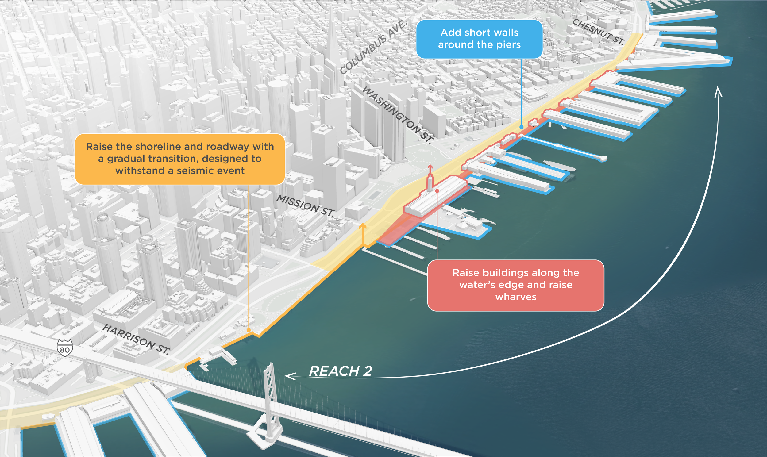
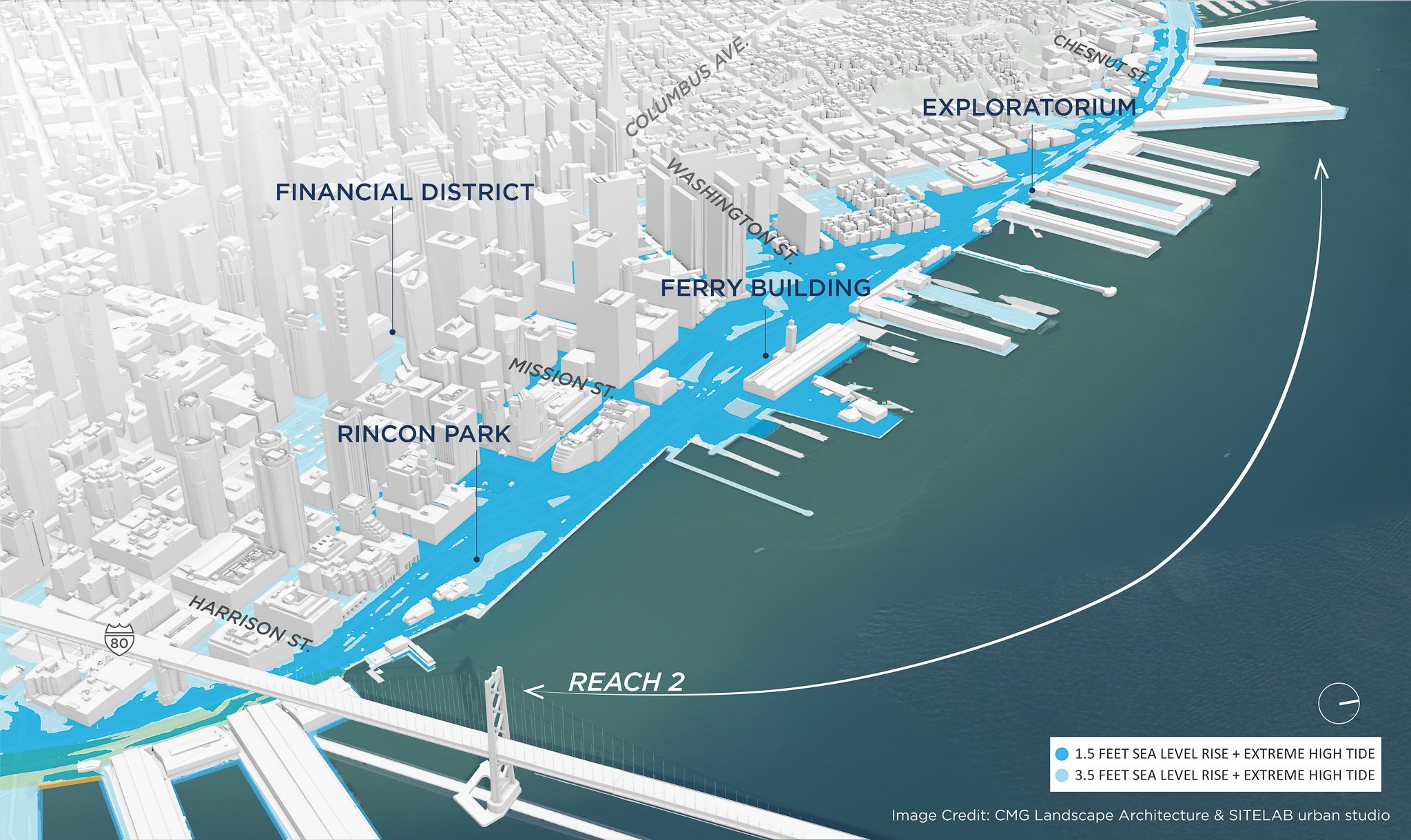
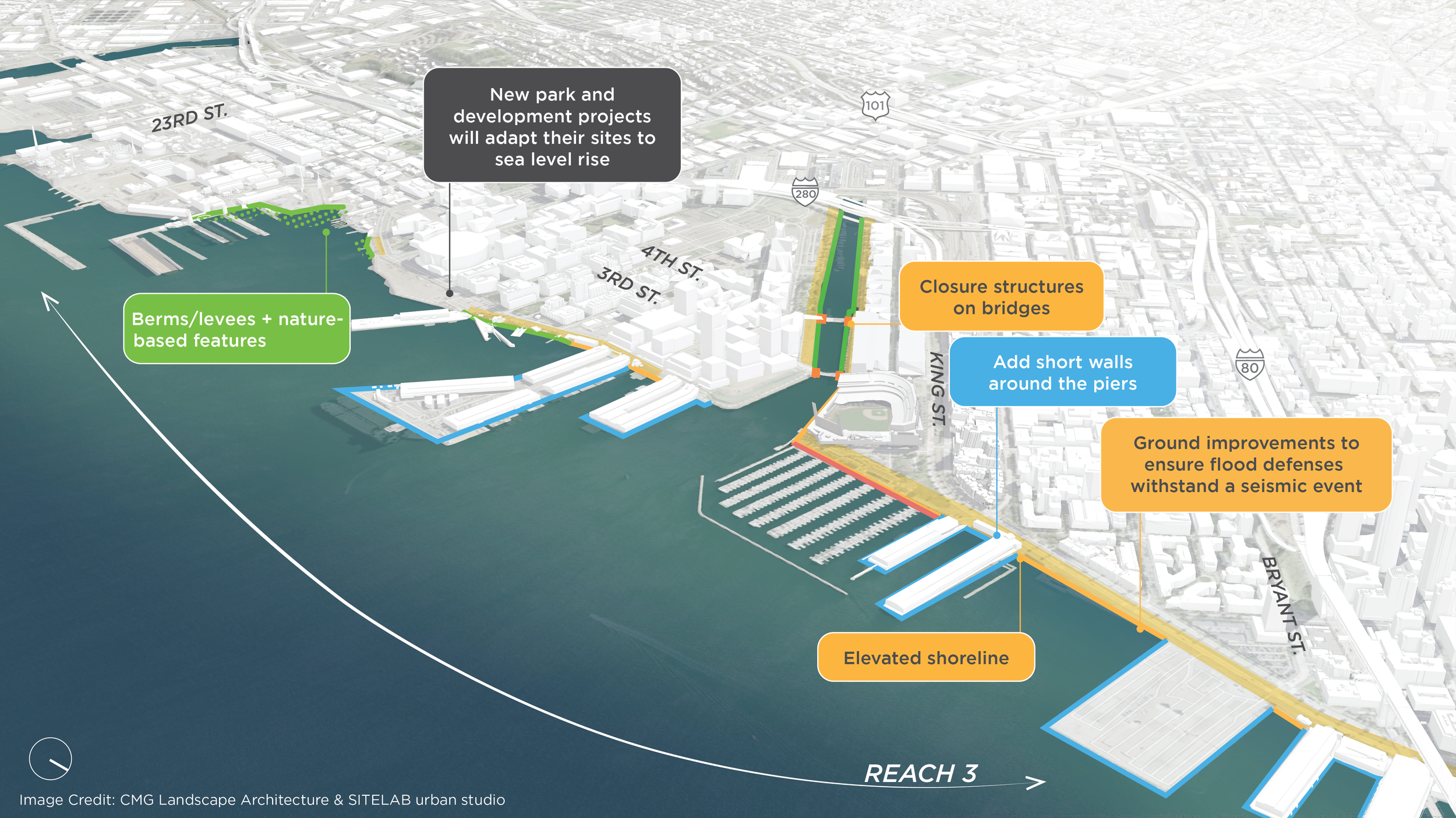
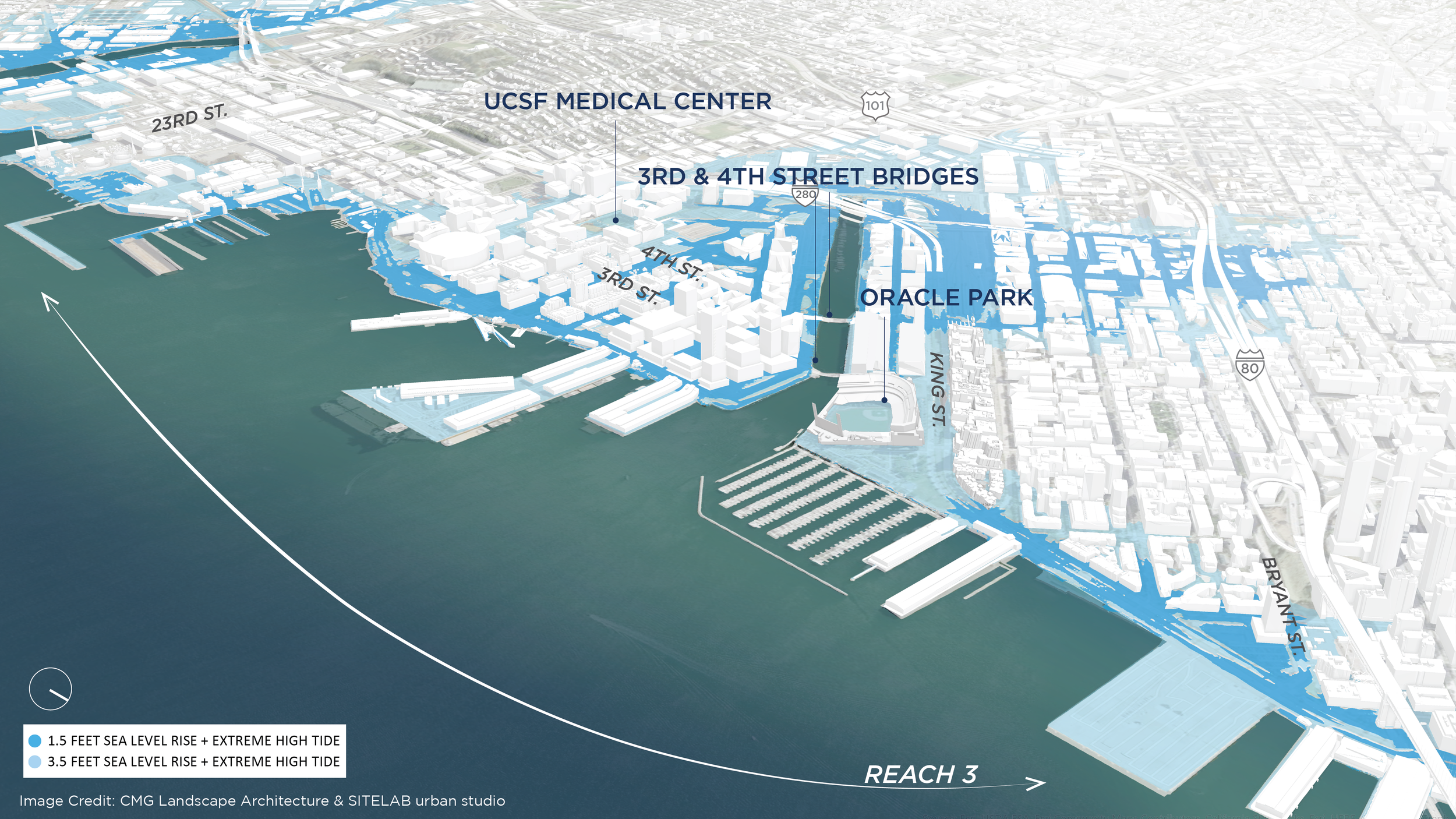
Hold the Line - 2090
Engaging the Public
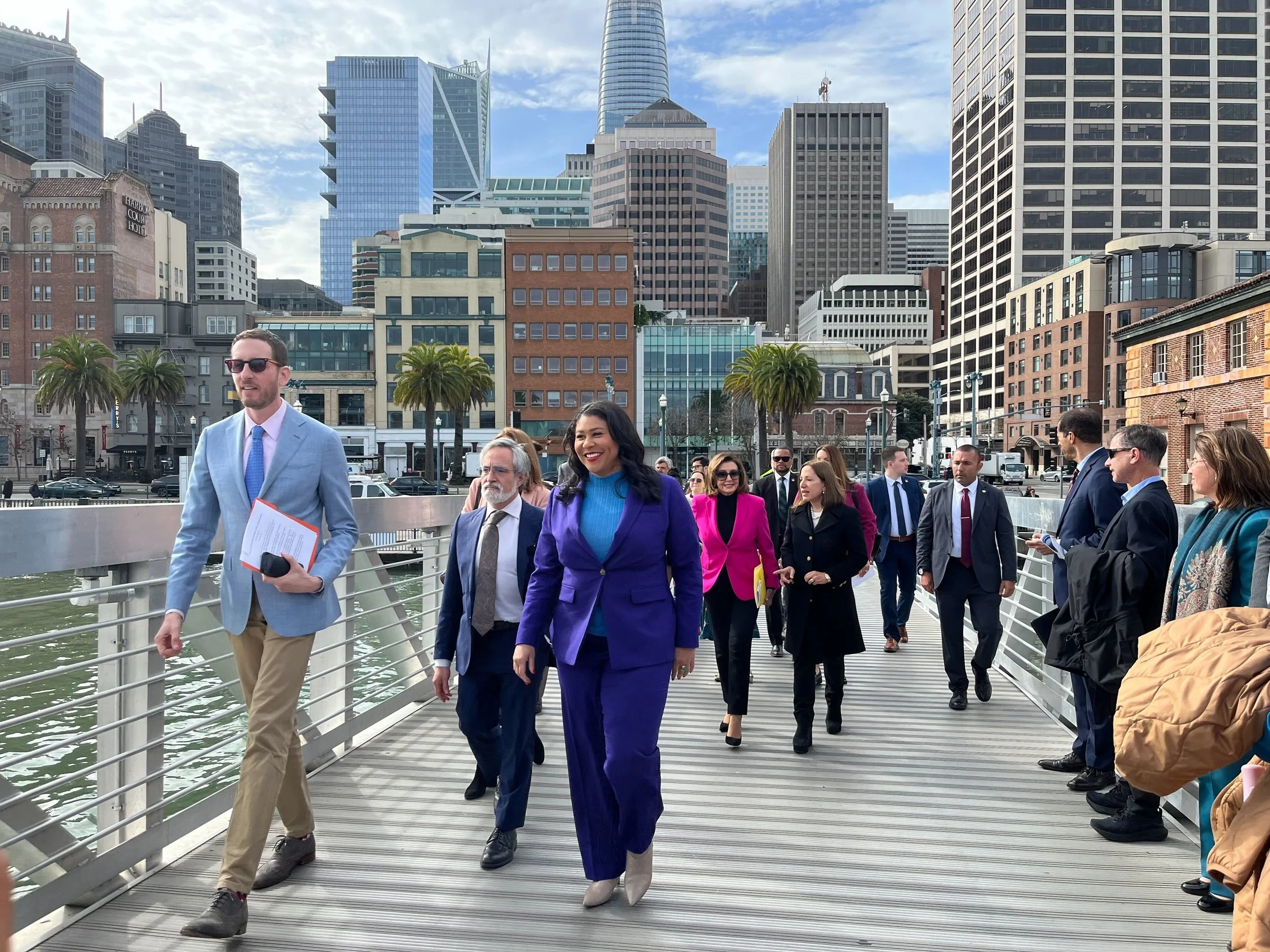
The development of the Draft Waterfront Adaptation Strategies and the resulting Draft Plan is a reflection of five-plus years of citywide community engagement that has connected with tens of thousands of San Franciscans on what a resilient, sustainable, equitable waterfront means to them. Ongoing engagement of the strategies has included a community open house, walking tours, and digital events.
SITELAB’s approach is informed by technical studies of edge conditions, waterfront-wide analyses, stakeholder engagement findings, and is anchored in a series of urban design principles. Across all, SITELAB brings a people-first approach to resilience—building towards a future waterfront that creates equitable opportunity for all residents, workers, and visitors.


